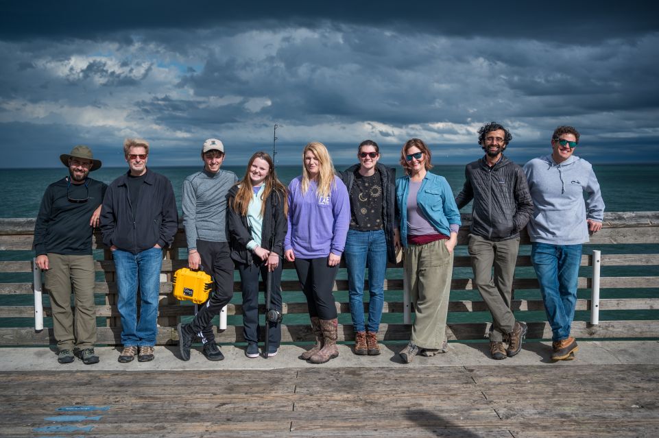
The history of the Outer Banks beaches is filled with stories of storms, erosion, and renourishment projects. When drastic events occur almost anyone can tell that their favorite beach spot has changed, but for some time scale variations of the landscape are often harder to notice without some sort of documentation. That is where ECU and CSI faculty like David Lagomasino, Kimberly Rogers, and Sid Narayan come into play. As part of their work, each is helping to document coastal change and its effects. However, on Thursday it was not about them. It was about their students.

As a part of the ECU Outer Banks Semester Experience at the Coast, Marco Agostini, Kaleigh Bell, Logan Willis, and Lauren Wright took a field trip to Jennette’s Pier to learn about beach profiling and ocean energy. Rogers and Narayan led the morning session teaching the students to collect data for a two-dimensional beach profile by using two poles, a meter stick, and pre-measured string. They attached the two poles using the string, and the students moved from dune to water line just as two referees would move the first down chains along the field during a football game. Every two meters, the students would measure and record the elevation at that point using only the meter stick and their eyes. Once at the waterline, the students could plot their data and connect the points to create their beach profile. The process took almost 30 minutes just to complete one transect and included a lot of room for error.
While the professors and students discussed where errors could have been made and what variables could have changed their results,
Spencer Wilkinson, a CSI lab technician researching coastal processes brought a Real Time Kinematic (RTK) GPS to the beach. He and the students walked the same transect as before, but this time it was much quicker. At each point, the RTK GPS was used to take coordinates and elevation which when plotted all together can give a more accurate beach profile than if done manually. While the technology could give a better reading, this method still proves to be time-consuming as additional transects would have to be run for a bigger picture profile.

After a lunch break across the street at Sam & Omie’s, everyone returned to Jennette’s to hear from Lagomasino who taught the students about terrestrial laser scans. Prior to the field trip, using a piece of equipment known as the Terrestrial Laser Scanner (TLS), Lagomasino collected a scan of the entire beach surrounding the pier within just a few seconds and then made a three-dimensional model which he prepared for the field trip. The TLS sent millions of laser pulses in all directions, and when the laser hit an object it was reflected back to the sensors. The information the sensors collected was used to create the highly accurate model of the beach and dunes Lagomasino showed the students.
When the TLS presentation was complete, the field trip switched gears. It was time to focus on ocean energy, and Mike Muglia led the way. From the balcony of the pier, Muglia had the students watch the water for a few moments and make observations. All agreed there were some darker areas of upwelling, but towards the end of the pier, the water seemed to be more clear. The weather patterns and ocean currents of the previous few days had resulted in a south swell, and Muglia and the
students wondered if the Hatteras Front, the boundary between the cooler Mid-Atlantic Bight water and the warmer, saltier water of the South Atlantic Bight, had moved as far north as Nags Head. Usually, the waters converge at the shelf near Cape Hatteras, thus the name Hatteras Front; however, with the right conditions, the front can sometimes move north. Muglia had the students test the water at different locations on the pier to determine if the front had possibly moved. They used a Conductivity, Temperature, and Depth (CDT) sensor which they dubbed the “clementine” to measure- you guessed it- conductivity, temperature, and depth. They were able to determine salinity from the conductivity measurement and then determined based on salinity and temperature that the water at the pier was likely not water of the boundary, as the salinity and temperature measures were slightly too low.

Though maybe not the exciting results they had hoped for, the students still had a fantastic time on their trip. When asked about what she thought of the day, Willis stated, “I learned a great deal and had the most fun when my group was able to survey the beach. It made it easier for me to learn and understand by being able to get my hands on the equipment and do it myself!” The students will have more opportunities in the following months for hands-on learning with additional field trips scheduled.
 ECU's Integrated Coastal Programs (ECU ICP) is a leader in coastal and marine research, education, and engagement. ECU ICP includes the Coastal Studies Institute, ECU's Department of Coastal Studies, and ECU Diving and Water Safety.
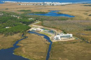 The ECU Outer Banks campus is home to the Coastal Studies Institute.

