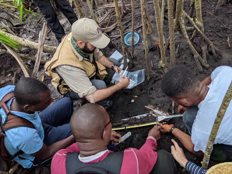
While the pandemic may have slowed some research around the world, it certainly did not keep Dr. David Lagomasino from keeping busy this spring. Between the end of January and the beginning of April, Lagomasino was listed as a co-author for five recently published papers. While each article is fairly different in nature, they all share some common themes: remote sensing data and natural resource management applications. Below is a summary for each paper as well as a link to each full publication.
Space‐Borne Cloud‐Native Satellite‐Derived Bathymetry (SDB) Models Using ICESat‐2 and Sentinel‐2
Maps of shallow seafloor topography (bathymetry) in coastal areas can be important tools used by decision-makers and stakeholders for a variety of things, including, but not limited to, marine navigation, aquaculture, climate change adaption and mitigation, coastal resilience and disaster recovery. Yet, despite their importance, bathymetric maps are often inaccurate, incomplete, or not immediately available. Manually mapping the seafloor is an arduous, challenging task and can also be very expensive.
To combat mapping issues, a team of researchers including Lagomasino recently produced a publication in which they utilized remote sensing data from a NASA satellite known as ICESat-2 and combined it with imagery from another satellite from the European Space Agency called Sentinel-2. The combination of the two produced bathymetric maps which proved to be just as accurate, if not more, than maps made with field-collected measurements. Additionally, this new means of production is much faster and cheaper than traditional methods.
By utilizing satellite data that is openly available, the team has found means to make accurate, detailed bathymetric maps (like that above) more accessible to coastal communities, and thus made contributions to the development of the Blue Economy. The ease with which the maps can be produced will allow future researchers more flexibility when it comes to analyzing coastal changes over different periods of time, and it will also allow analysts and community members to understand disaster impacts and recovery progress in a timelier manner. While bathymetric maps were only made for three places in this study, the methods used are transferable and could soon lead to the development of a global map of shallow seafloor topography. Additionally, in future work, the authors hope to scale up their approach to be able to aid in mapping seagrass and other shallow water ecosystems.
Large-Scale High-Resolution Coastal Mangrove Forests Mapping Across West Africa With Machine Learning Ensemble and Satellite Big Data
Despite the increased availability of remote-sensing datasets like those used in the study above, the use of such data is often hindered when it comes to using machine learning algorithms for land cover mapping. The algorithms used to attempt large-scale, high resolution land cover mapping are relatively new, and the issues presented are often exacerbated in places like West Africa where cloud cover can make satellite data unusable.
Land cover mapping can have great implications for forest resource inventory, agricultural monitoring, and environmental change. Though small in forest extant, mangroves make up a significant proportion of tropical forest carbon sequestration, which is needed to combat climate change, and the forests themselves provide coastal protection. Previously rendered maps have been produced at a spatial resolution of 30 m which is sometimes not fine enough to distinguish mangroves from their surroundings. Thus, Lagomasino and colleagues set out to develop better land-cover mapping methods for mangrove areas. Their study analyzed data from West Africa, a region which has approximately 17,000 km2 of mangrove coverage.
Using a combination of three machine-learning models and two satellite datasets, the researchers were able to finally produce a large-scale map of mangroves in West Africa with a spatial resolution of 20 m. The more refined spatial resolution will allow machines and researchers to better distinguish smaller areas mangroves within coastal areas, and their results and methods will aid in providing maps for other areas of interest worldwide. As land cover maps become both more accurate and more accessible, monitoring and assessing mangrove forests will become easier and thus critical information can be supplied more readily in regard to climate change mitigation, coastal adaptations and development, and clean water sources.
Trees Outside Forests are an Underestimated Resource in a Country with Low Forest Cover
Other harder to map resources are trees outside of forests, or TOF. In countries where there aren’t many forests, TOF are an incredibly important yet often underrepresented resource. In developing nations, TOF can account for up to two-thirds of fuel wood, yet, national resource assessments often underestimate the availability of timber. Field surveys are both time and labor-intensive, and land cover maps have not been produced with enough fine resolution to accurately estimate TOF. Thus, with Bangladesh as the focus of their study, Lagomasino and colleagues used data from different satellites to produce maps of TOF and mean tree canopy height.
By combining the datasets, the team was able to produce TOF and tree canopy height maps at a resolution of 10 m. They mapped 2,233,578 ha of TOF in Bangladesh with a mean canopy height of 7.3 m. Furthermore, they mapped 31% more TOF and 53% more forest than existing estimates showed. These results have both ecologic and economic implications. They indicate that though Bangladesh’s tree cover is fragmented, the nation is capable of maintaining connectedness between remaining stands which is important for effective wildlife corridors. Additionally, the gap between timber supply and demand may be less than originally thought in Bangladesh.
Thanks to the work of the researchers, nations around the world now have the ability to gain an accurate estimation of TOF extant and height which may increase their capacities for monitoring tree resources and aid in future national resource accounting.
Future Carbon Emissions from Global Mangrove Forest Loss
Lagomasino also recently contributed to a study which analyzed carbon emissions as a result of mangrove forest lost around the world. In recent years, the ability of mangroves to sequester large amounts of carbon for extended periods of time has been recognized, and as such, mangrove forests are often labeled as “blue carbon” ecosystems. In other words, mangroves are incredibly important for offsetting carbon emissions that contribute to climate change.

When the forests are altered and damaged, either from natural disaster or human practices, the carbon the mangroves hold is released back into the atmosphere. Lagomasino and his colleagues used global datasets for carbon stocks, mangrove distribution, deforestation rates, land-use change, and emission factors to create computer models which in turn can predict future carbon emissions from mangrove loss.
Their analysis revealed several hotspots that accounted for 90% of predicted emissions from future mangrove loss. The three highest emitting locations were a result of land-use conversion in the way of deforestation to make room for rice, oil palm, aquaculture, and rubber plantations. Hotspots with lower, yet still significant, emissions were heavily impacted by erosion due to coastal development, severe weather, and interrupted hydrological connections.
Being able to identify issues pertaining to mangrove loss emissions, also meant offering some solutions to mitigate mangrove losses and carbon emissions in the future. Improving agricultural practices to reduce further expansion into undisturbed forests, stabilizing coastlines, and restoring former mangrove areas are all examples of ways in which communities could shift to decrease emissions moving forward.
The Large Footprint of Small-Scale Artisanal Gold Mining in Ghana
Vegetation loss in coastal ecosystems is also of concern in Ghana, though in this case the deforestation has occurred as a result of the artisanal gold mining, or Galamsey, industry. Gold mining has played a significant role in Ghana’s economy for centuries, allowing the country to become the 7th largest producer of gold worldwide.
While the industry has provided economic benefits to local communities, the environmental and health impacts of mining can be devastating. Regulation of this industry has varied over time and the expansion of artisanal mining has escalated in recent years, and many of these artisanal mines are not only harmful to human health, but also leave a significant footprint on terrestrial ecosystems. Exploration and extraction of surface mining requires deforestation, land-clearing, and excavation; and the mines are often abandoned after exploitation with little effort to remediate, making it difficult for forest regrowth or other development to occur. Artisanal gold mining has also been identified as a risk for aquatic ecosystems as mine tailings and runoff can cause downstream issues like excess flooding and water degradation, leaching of mercury, and increased siltation and suspended particles in waterways.
In order to better understand the impacts of gold mining to Ghana’s coastal ecosystems, a team which included Lagomasino and CSI Research Specialist Amanda Payton quantified the total footprint of vegetation loss due to artisanal gold mines in Ghana from 2005 to 2019. They estimated yearly conversion from 2007 to 2017 to discover how conversion varied over the decade by using satellite imagery, machine learning, and change detection algorithms. Within the study area of southwestern Ghana, their results indicated that new mining activity caused deforestation at an average rate of ~5200 football fields per year for the last 14 years and that a high percentage (~50%) of this mining occurred between 2014 and 2017.

Amanda Peyton, CSI Research Specialist.
In addition to deforestation, increased artisanal mining activity in recent years has the potential to affect human health, access to drinking water resources and food security. This work expands upon limited research into the spatial footprint of Galamsey in Ghana, complements mapping efforts by local geographers, and will support efforts by the government of Ghana to monitor deforestation caused by artisanal mining.
 ECU's Integrated Coastal Programs (ECU ICP) is a leader in coastal and marine research, education, and engagement. ECU ICP includes the Coastal Studies Institute, ECU's Department of Coastal Studies, and ECU Diving and Water Safety.
 The ECU Outer Banks campus is home to the Coastal Studies Institute.

